Location
Kashmir | India
Average Trekking
48 km
Duration
7 Days
Difficulty
Moderate
Altitude
13,500 Ft
Sister of Kashmir Lake Trek
Kashmir | India
48 km
7 Days
Moderate
13,500 Ft
01
02
03
04
06
01 Fri
29 Fri
01
01
01
01
01
01 Sun
29 Sun
01
01
01
01
01
01 Sun
29 Sun
01
01
01
01
01
01 Sun
29 Sun
01
01
01
01
01
01 Sun
29 Sun
Jammu kashmir
48 Km
7 Days
Easy to Moderate
13,500 Ft
• Srinagar to Srinagar
• Veg meals: breakfast, Lunch, Evening snacks and dinner
• Tents(triple/double sharing), SleepingBags, Sleepingmatts
• Gears: Micro spikes and Gaiters as per snow conditions
• Accomodation in hostel / Guest house on Day1
• Experienced and Qualified Guides
• Friendly and Supportive staff
• Forest permits
• Medical Amenities: First Aid Kits, oximeter, oxygen cylinder
• Sanitised and Hygienic camp site and hostels
• Mode of Transportation
• Numbers of people (1-4): Hatch back - Alto, Swift or Equivalent Vehicle
• Numbers of people (5-8): tata sumo/Mahindra bolero or equivalent
vehicle
• Numbers of people (9-12): Temp travel
• Anything not mentioned in the list
• Meal during transportation
• Any kind of personal expenses during trek
• Porter/mule-charges (Personal), Backpack offloading charge
• Unscheduled or extended stay due to road blocks, landslides, bad weatherandsnowfall
• Cost of evacuation in-case of an emergency
The Mountain Vibes.
We get that a travel and adventure enthusiast like you will be as bumped about cancelling a trek as us but we also understand that you may have to cancel the trek for any unforeseen reason and therefore the Cancellation Service of The Mountain Vibes does not return the advance amount paid by the trekkers instead we provide a voucher for the exact amount which is equivalent to the amount paid by you.
Terms & Conditions for the cash voucher:
Trek Name: TARSAR MARSAR TREK
Days: 7
Adventure Type: Trekking
Base Camp: Aru
Season: Monsoon |
Month: July | August | September |
Distance: 48 Km.
Trail Type: Circle trail | Camping in various locations, starting and ending at the same point.
Country: India
Location: Kashmir
Altitude: 13,500 Ft.
Grade: Moderate
Stay: Hotel and teahouse
Food: Meals while on trek & at Hotel/Guesthouse (Veg & Eggs)
Twin Alpine Lakes: The trek is renowned for the stunning twin lakes, Tarsar and Marsar, nestled in the Kashmir Valley. These pristine, high-altitude lakes are surrounded by snow-capped peaks and lush meadows.
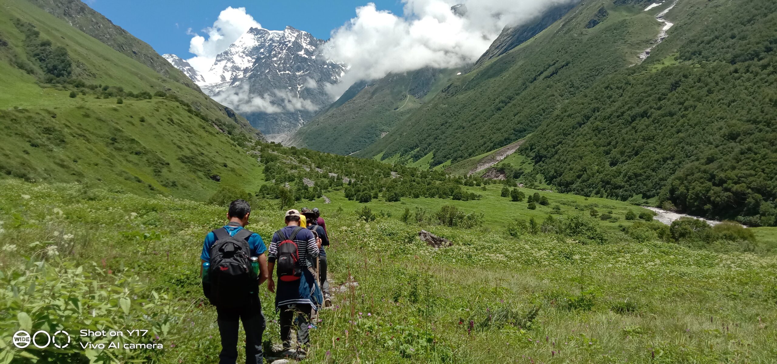
Breathtaking Meadows: Experience the lush, expansive meadows of Aru, Lidderwat, and Shekwas, carpeted with wildflowers in the summer and offering panoramic views of the surrounding mountains.
Scenic Campsites: Camp beside the tranquil lakes and amidst the meadows, with some of the most picturesque camping spots in the Himalayas.
Diverse Landscapes: The trek offers a variety of landscapes, from dense pine forests to rolling meadows, rocky terrains, and serene alpine lakes.
Solitude and Serenity: Unlike many popular treks, the Tarsar Marsar Trek provides a sense of solitude and peace, away from the more crowded trekking routes, making it a perfect escape into nature.
Wildlife: The trek takes you through the Dachigam National Park, where you might spot the endangered Kashmir stag (Hangul), along with other wildlife like Himalayan marmots, and various bird species.
Kashmiri Culture: Interact with the local Gujjar and Bakarwal shepherds, experiencing the unique culture and traditions of the people who inhabit the region.
Acclimatization: Although the trek is not extremely high-altitude, proper acclimatization is still important. Spend a day in Aru or another base camp to adjust before starting the trek.
Physical Fitness: Prepare with regular cardiovascular exercises and strength training, as the trek involves long walking hours, steep ascents, and descents.
Weather Preparedness: Kashmir’s weather can be unpredictable. Be prepared for sudden rain or temperature drops by carrying layered clothing, a waterproof jacket, and thermal wear.
Altitude Sickness: Be aware of the early signs of altitude sickness, even though the trek doesn’t reach extreme altitudes. If you experience symptoms like headaches or dizziness, take a break and hydrate.
Trekking Gear: Wear sturdy, waterproof trekking boots with good ankle support. A pair of trekking poles can be useful for maintaining balance, especially on steep and uneven terrain.
Hydration: Keep hydrated by drinking plenty of water, especially when trekking at higher altitudes. Carry water purification tablets or a portable filter to refill from natural sources.
Navigation: While the trek is generally well-marked, it’s advisable to trek with a local guide or in a group to avoid getting lost, particularly in areas where fog or bad weather can obscure the path.
Please note that prepaid sim cards do not work in Kashmir.
Don’t forget your ID proof in original and 2 photocopies.
Our first-day destination is Aru on the banks of Lidder and Aru Rivers, situated 12 km off Pahalgam. A fairly developed tourist stop, Aru is regarded as the main base for two well-loved treks – the Tarsar Marsar and Kolahoi Glacier Trek, the destination of the latter being the origin of the Lidder-Aru Rivers.
Our representatives will meet you in Srinagar and from there you will take a short 3 to 4 hrs drive to Aru via Pahalgam. From Pahalgam, two routes go towards Aru, one through the village of Anantnag and one through Bijbhera. Bhijbera route is a tourist trail that presents the beautiful rural scenery of Kashmir with apple orchards, apricot, and walnut trees. Since a steady telephonic network cannot be confirmed at Aru, you need to wrap up your communication at Pahalgam itself. At Aru, you will be welcomed at a riverside camping zone, off the touristy hub, by the sweet-flowing Lidder. There are lots of activities around the town at Aru– from trout fishing in Lidder, and the Aru Biosphere Reserve to horseback riding and heliskiing in winter. You can explore and mark these for a later visit because we will be reaching quite late into the dusk around 6 pm.
Today we will be following the Lidder River upstream. The trail starts right out of the village and follows the course of the river. It is a long but gentle climb to Lidderwat. After about 9 to 10 km the trail moves up soft slopes, entering a thicket of conifers, revealing a sweeping view of the Aru Valley down below on the left side. We continue venturing through the forest shade before we arrive at a clearing filled with Gujjar huts. This is the Nandekai Village, inhabited by seasonal, migrating shepherd people, and agrarian, foraging Gujjar community. Here is a slice of idyll, picture-perfect, and a far call from life as we know it. We won’t be crossing through the heart of the village but rather get a priceless bird’s eye view of the picturesque setting as we move uphill. A little after we enter a tumbling meadow as the fir tree thickets completely ebbs away. This is still part of the Gujjar Village ecosystem and you are going to find horse-riding folks and cattle grazers.
Lorem ipsum dolor sit amet, consectetur adipiscing elit. Ut elit tellus, luctus nec ullamcorper mattis, pulvinar dapibus leo.
The trail cuts across a couple of valley streams next as we go. We soon come across a crude log bridge over the second brook. The streams are very clear and it is safe to drink the water in the stream. This is the spot to refill our water and take some rest, maybe have the packed lunch carried from the last campsite. The Lidderwat locale is still an hour’s journey from here.
The trail here curves into another wooded area of gorgeous firs before coming out into the meadows of Lidderwat, where the river flows clear watered. We can find quaint little Gujjar settlements that mark the very locale. Thanks to tourist inflow in recent times, there are also Pahalgam District Authority Huts and food places established for comfortable stays. There are enough places to pitch camps in this section of the trail.
Our camp would be at a quiet spot close to the stream which is nothing short of a dream. There should be enough time before sundown to walk around the peaceful fir tree-shaded Gujjar settlement and explore the meadows, and then lay out in the dying light on soft grass by the streamside to soak in the tranquillity.
Today we trek approx 5 hours along a trail winding up directly from behind the PDA homes. The trail starts alongside the Lidder River and in a matter of half an hour you will find yourself inside a forest of pines, the Lidder River is now a distant shadow and the meadows have ebbed away. The woods are not very thick and occasionally open up to wide clearings.
Soon, you will find the stretch of Lidderwat coalescing with a more vast expanse of merging valleys and snow-covered peaks rising straight from the base of the valleys. The grasslands now merge such that it is no longer a single valley but a convergence of many valleys together. There will be multiple clear water streams cutting across our path where you can stop to refill your water bottles.
We will now be heading towards Homwas, which is a little clearing inhabited by a cluster of Gujjar huts and it falls on the other side of the river. After crossing a log bridge, we are ushered into a locality with a few homes and tea shops. You will never fail to find warm hospitality with these villagers and despite the exhaustion of the travels, this makes one’s day.
Crossing the village, you will walk parallel to the crystal river before you enter a different grassy landscape. The walk from Homwas to Shekwas is a delight as you mostly walk on the soft grass. Soon you will arrive at Shekwas. The trail now follows in a south-westerly direction and enters a narrow valley where a beautiful river constantly keeps you company. You will keep gaining altitude and in an hour, you will enter a cluster of Bhoj trees that unfolds into a green scenery stretching in gentle folds to as long as the eyes can see, the meadows of Shekwas are breathtaking. Gujjar habitation and hospitality are ubiquitous in this area too and their little low-roofed, leaf-thatched huts dot the lush landscape here and there. Our trail climbs past the huts onto a slightly higher camping ground. A sweet night, a star-studded night falls over the meadows.
From Shekwas, the trail entwines along a grassy landscape for a while. The green moors of Shekwas are best experienced with bare feet. Try this as you set out of Tarsar Lake today. The agenda today is the trek to the first lake, Tarsar. The trail moves through a silken lawn of nature for some time before climbing over a humpbacked hill and after crossing a few ridges you get a little peek of Tarsar’s magnetic blue waters. You will follow a westward direction in general.
It takes a total of 5 hours to reach Tarsar from Shekwas, the view of the lake widening as we go down succeeding smaller ridges. Every ridge on the trail opens to a stupendous view. The views of the snow-clad peaks become grander as we get closer to the lake. You need to cross the stream, jumping from boulder to boulder adventurously before finally gliding into a verdant meadow around the lake where we will camp at night. Sink your feet deep into the soft grass and watch how the lake water reflects the passing hues of the sky as the day rolls on. Time seems to come to a standstill amid such beauty and silence. There are plenty of flat open spots by the lake where you can pitch your tent. Remember that the entire trek takes place along an eco-friendly zone so please do not litter around the lake or anywhere along your trek and encourage others to not do the same.
Today we will trek another 6 km to the adjoining Sundarsar Valley through Tarsar Pass. We delve into a connecting stretch first which joins the meadows of Shekwas and Sundersar Valley. Trekking through the Tarsar Pass is time-saving. Climbing the pass saves about 3 to 4 hrs of the trek. The Tarsar Pass presents beautiful views of the valley that spans out so beautifully. Descend from the pass via the shepherd’s trail and a couple of minutes later, you can spot a few Bakkarval shelters on the left side. From behind the shelter, the trail climbs up to a knoll. Past the knoll is the view of a lush meadow of such astounding beauty that it would inspire poets to emote poetry. Sheep and horses graze on the pastures unmindful of your presence. These are one of the most beautiful meadows with a large pond in the middle and in the backdrop, the snow-covered mountains enhance the scenery. You have to cross a ridge top and climb down to reach the green landscapes of Sundarsar.
You can actually test your stamina on this day’s trek after so many days of walking on gentle undulations. On the ascent to the pass, the trail gets steeper but then mellows down to a gentler slope to Sundarsar. The highlight of the stretch comes with a view of Tarsar Lake from the other side of the Pass. The lakeside offers a perfect camping spot to set up your tents for the night.
Today we will ascend higher up through Marsar Ridge. Kilting our way around Sundarsar shores, we will be directed to a boulder-smitten path. Two passes from Sundarsar will take you to Marsar Lake. The boulder-laden route that we take is the quicker one. You can expect slippery snow patched in these rock crevasses, just like the white-covered mountains at the end of the valley that we witnessed through our trek in the last few days. At midday, the snow will melt and it’s going to be a tricky walk. Trekking poles and ice axes can be quite a blessing here.
After covering a partly grass-covered, partly snow-sheeted rock trail over the pass, we slightly descend to a flatland that’s cut through by occasional water flows. Keep to the trail on the left and you will spot a ridge that climbs from your left and to the front. They pass a beautiful stretch of green that leads to flatter grounds and after crossing the grassy stretch and hopping over some brooks, you will spot another ridge on your left. The top of the ridge view reveals the translucent blue Marsar Lake lying somewhere down below. It has the same kind of almond-shaped outline as Tarsar and is almost as big. Snow-covered mountains line along the edge of the lake, offsetting its blueness. The lake happens to overflow on one side and go down in a sweeping glacial stream down to a valley below. The snow melts from the white cliffs and feeds its waters on one side and another side, the Dachigam forest starts. The forest reserve climbs almost up to the lake shores. After spending some time at Marsar Lake we will get back to Sundarsar.
We descend back to Sundarsar camps and then to Homwas, trailing almost along the same way that we came by. It takes about 40 minutes of a downhill climb to reach Sundarsar. The descent is full of nostalgia as you relive your experience on the trail once more. Homwas is reached before nightfall, slightly exhausted.
Please note that prepaid sim cards do not work in Kashmir.
Don’t forget your ID proof in original and 2 photocopies.
Starting off early morning today, we descend from Homwas to Aru, sweeping over the same enchanting meadowlands we had experienced on the first days, and the same Lidder River, now to be followed downstream. Descending through this trail will give you some sights that you missed previously when climbing up. This includes the views of the shrinking Kolahoi glacier and the pine forests of Lidderwat from a whole new perspective.
We will stop at Lidderwat to rest and have lunch and then set off again, now towards Aru, 10 km from Lidderwat. It takes about 4 hours approx. to cover the distance.
Srinagar-bound vehicles shall be waiting for us at Aru. We can expect to reach the station within 8 at night.
Please note that prepaid sim cards do not work in Kashmir.
Don’t forget your ID proof in original and 2 photocopies.
Drive from Rishikesh to Lohajung
Your trek will start today, after a nutrition-rich breakfast and a brief explanation by our trek leader you will begin your trek towards a jeep road which connects to the village of Wan. After that, your next location is Kulling which is a tiny village surrounded by large mountains and stunning views with a handful of population. The village of Kulling is home to exotic birds and pure air. You can take a small break to observe the above-mentioned things and then resume your walk, on your way you will see a small stream which is connected to the larger stream Neel Ganga, on descending further you will encounter the mainstream. Further on your trek, you’ll cross a bridge and will trek further where the final destination for the day is waiting for you. Didna Village is surrounded by alpine forests and huge open fields. After reaching your destination you’ll be served lunch and you can finally take a rest for the day.
Today you will be reaching Ali Bugyal, a village which is known as the highest inhabited location of India. The village is 11,000 Feet above sea level, and the hike to the hilltop will start from the Didna village. The Ali Bugyal is green pasture land and looks like someone has painted a beautiful and colourful landscape. Take your take and enjoy the beauty of the village, talk with the shepherds, they usually have the best stories to share, and if you are lucky enough you will hear a melodious folk song from them. Walking along the trail unwinding in all the beauty you will finally reach the mega-beauty Ali Bugyal. We agree that the whole trek of Ali Bedni Bugyal is a breathtaking one with mind-blowing views but what Ali Bugyal has for you to offer is something else. The different shades of green are perfectly balanced with the white and blue background of the Himalayan mountain ranges, the most prominent among which is Mt. Trishul. And this is just not true if you have to trek for half an hour more to the Bedni where you will find your campsite for the day. After reaching Bedni enjoy around the Bedni kund, relax, explore the temple and sign off to your tents.
Today is the day when you will actually explore the second half of the Bugyals, The Bedni Bugyal. Just like Ali Bugyals, you will find a gorgeous view of the greens with the white and blue in the background in front of your eyes. You will find vibrant and different colours of flowers during the summer. Take your time to enjoy the views, have your packed lunch in the meadows itself, click good pictures and then proceed towards the Ghairoli Patal (follow the descending route) The trail makes its way through the forests, dark, deep, thick forests. Don’t rush walk with your time as there is a high chance of you rushing and tumbling over. You will spot an open ground amidst the forest. It is your campsite for the day Ghairoli Patal. Have a warm dinner and depart to your assigned tents.
Altitude Loss: 10,500-7,650 Ft. The final day of your trek is here, retrace your step back to the campsite village: Lohajung. Step back to the Neel Ganga bridge, after that your next stop is Wan village (also known as Ran ka Dhar) If you want you may spend some time with the locals, click some snaps and then proceed forward towards the road ahead, a car will wait for you to take you to Lohajung. After reaching Lohajung, relax, if you want you can explore the local market and accommodate yourself in the guesthouse
Lohajung to Rishikesh After a yummy and nutrition-rich breakfast you’ll finally bid your final bye to the beautiful village of Lohajung, but you are not going alone a bag full of memories is coming with you too.
TARSAR MARSAR TREK PACKAGE
Batch – November – 2023
Batch – December – 2023
Batch – January – 2023
Please note that prepaid sim cards do not work in Kashmir.
Drive from Rishikesh to Lohajung
Your trek will start today, after a nutrition-rich breakfast and a brief explanation by our trek leader you will begin your trek towards a jeep road which connects to the village of Wan. After that, your next location is Kulling which is a tiny village surrounded by large mountains and stunning views with a handful of population. The village of Kulling is home to exotic birds and pure air. You can take a small break to observe the above-mentioned things and then resume your walk, on your way you will see a small stream which is connected to the larger stream Neel Ganga, on descending further you will encounter the mainstream. Further on your trek, you’ll cross a bridge and will trek further where the final destination for the day is waiting for you. Didna Village is surrounded by alpine forests and huge open fields. After reaching your destination you’ll be served lunch and you can finally take a rest for the day.
Today you will be reaching Ali Bugyal, a village which is known as the highest inhabited location of India. The village is 11,000 Feet above sea level, and the hike to the hilltop will start from the Didna village. The Ali Bugyal is green pasture land and looks like someone has painted a beautiful and colourful landscape. Take your take and enjoy the beauty of the village, talk with the shepherds, they usually have the best stories to share, and if you are lucky enough you will hear a melodious folk song from them. Walking along the trail unwinding in all the beauty you will finally reach the mega-beauty Ali Bugyal. We agree that the whole trek of Ali Bedni Bugyal is a breathtaking one with mind-blowing views but what Ali Bugyal has for you to offer is something else. The different shades of green are perfectly balanced with the white and blue background of the Himalayan mountain ranges, the most prominent among which is Mt. Trishul. And this is just not true if you have to trek for half an hour more to the Bedni where you will find your campsite for the day. After reaching Bedni enjoy around the Bedni kund, relax, explore the temple and sign off to your tents.
Today is the day when you will actually explore the second half of the Bugyals, The Bedni Bugyal. Just like Ali Bugyals, you will find a gorgeous view of the greens with the white and blue in the background in front of your eyes. You will find vibrant and different colours of flowers during the summer. Take your time to enjoy the views, have your packed lunch in the meadows itself, click good pictures and then proceed towards the Ghairoli Patal (follow the descending route) The trail makes its way through the forests, dark, deep, thick forests. Don’t rush walk with your time as there is a high chance of you rushing and tumbling over. You will spot an open ground amidst the forest. It is your campsite for the day Ghairoli Patal. Have a warm dinner and depart to your assigned tents.
Altitude Loss: 10,500-7,650 Ft. The final day of your trek is here, retrace your step back to the campsite village: Lohajung. Step back to the Neel Ganga bridge, after that your next stop is Wan village (also known as Ran ka Dhar) If you want you may spend some time with the locals, click some snaps and then proceed forward towards the road ahead, a car will wait for you to take you to Lohajung. After reaching Lohajung, relax, if you want you can explore the local market and accommodate yourself in the guesthouse
Lohajung to Rishikesh After a yummy and nutrition-rich breakfast you’ll finally bid your final bye to the beautiful village of Lohajung, but you are not going alone a bag full of memories is coming with you too.
Please note that prepaid sim cards do not work in Kashmir.
Don’t forget your ID proof in original and 2 photocopies.
Drive from Rishikesh to Lohajung
Your trek will start today, after a nutrition-rich breakfast and a brief explanation by our trek leader you will begin your trek towards a jeep road which connects to the village of Wan. After that, your next location is Kulling which is a tiny village surrounded by large mountains and stunning views with a handful of population. The village of Kulling is home to exotic birds and pure air. You can take a small break to observe the above-mentioned things and then resume your walk, on your way you will see a small stream which is connected to the larger stream Neel Ganga, on descending further you will encounter the mainstream. Further on your trek, you’ll cross a bridge and will trek further where the final destination for the day is waiting for you. Didna Village is surrounded by alpine forests and huge open fields. After reaching your destination you’ll be served lunch and you can finally take a rest for the day.
Today you will be reaching Ali Bugyal, a village which is known as the highest inhabited location of India. The village is 11,000 Feet above sea level, and the hike to the hilltop will start from the Didna village. The Ali Bugyal is green pasture land and looks like someone has painted a beautiful and colourful landscape. Take your take and enjoy the beauty of the village, talk with the shepherds, they usually have the best stories to share, and if you are lucky enough you will hear a melodious folk song from them. Walking along the trail unwinding in all the beauty you will finally reach the mega-beauty Ali Bugyal. We agree that the whole trek of Ali Bedni Bugyal is a breathtaking one with mind-blowing views but what Ali Bugyal has for you to offer is something else. The different shades of green are perfectly balanced with the white and blue background of the Himalayan mountain ranges, the most prominent among which is Mt. Trishul. And this is just not true if you have to trek for half an hour more to the Bedni where you will find your campsite for the day. After reaching Bedni enjoy around the Bedni kund, relax, explore the temple and sign off to your tents.
Today is the day when you will actually explore the second half of the Bugyals, The Bedni Bugyal. Just like Ali Bugyals, you will find a gorgeous view of the greens with the white and blue in the background in front of your eyes. You will find vibrant and different colours of flowers during the summer. Take your time to enjoy the views, have your packed lunch in the meadows itself, click good pictures and then proceed towards the Ghairoli Patal (follow the descending route) The trail makes its way through the forests, dark, deep, thick forests. Don’t rush walk with your time as there is a high chance of you rushing and tumbling over. You will spot an open ground amidst the forest. It is your campsite for the day Ghairoli Patal. Have a warm dinner and depart to your assigned tents.
Altitude Loss: 10,500-7,650 Ft. The final day of your trek is here, retrace your step back to the campsite village: Lohajung. Step back to the Neel Ganga bridge, after that your next stop is Wan village (also known as Ran ka Dhar) If you want you may spend some time with the locals, click some snaps and then proceed forward towards the road ahead, a car will wait for you to take you to Lohajung. After reaching Lohajung, relax, if you want you can explore the local market and accommodate yourself in the guesthouse
Lohajung to Rishikesh After a yummy and nutrition-rich breakfast you’ll finally bid your final bye to the beautiful village of Lohajung, but you are not going alone a bag full of memories is coming with you too.
Lorem ipsum dolor sit amet, consectetur adipisicing elit. Optio, neque qui velit. Magni dolorum quidem ipsam eligendi, totam, facilis laudantium cum accusamus ullam voluptatibus commodi numquam, error, est. Ea, consequatur.
1. If you are planning to fly to Srinagar which is well connected to all major airports in India, you can reach the Tourist reception center, Raj Bagh in appx 40 min via taxi from the airport (approx 13 Km).
2. If you’re coming by train, there are two railway stations.
3. If you are taking a bus from Jammu, then you have multiple options to take. There are two gates outside Jammu ISBT. You will get shared cabs from both of these gates.
4. If you are reaching the Railway Station, the share cabs to Srinagar will cost between Rs 700 to Rs 1000.
5. Shared cabs are more from the Jammu ISBT compared to the Railway Station. You can travel from the Railway station to the bus stand. The fare of the bus will be Rs 10. The auto will charge around Rs 80 to 120.
1. Transportation (as per the itinerary):
2. Insurance (Mandatory).
3. Food during the transit.
4. Any kind of personal expenses.
5. Mule or porter to carry personal luggage.
6. Emergency evacuation, hospitalization charge or etc.
7. Anything not specifically mentioned under the head Inclusion.
8. Hotel stay in Srinagar.
We get that a travel and adventure enthusiast like you will be as bumped about cancelling a trek as us but we also understand that you may have to cancel the trek for any unforeseen reason and therefore the Cancellation Service of The Mountain Vibes does not return the advance amount paid by the trekkers instead we provide a voucher for the exact amount which is equivalent to the amount paid by you.
_______________________________________________________________________________________________________________________
Terms & Conditions for the cash voucher:
Backpack with rain cover | (50 – 60 ltr) with comfortable shoulder straps |
Day pack with rain cover | 20 – 30 ltr (If off-load opted) |
Walking stick | Advisable (At least one) |
Water Bottle / Hydration pack | 2 bottles of one liter each, People who use hydration pack 1 hydration pack and 1 bottle of one liter, Carry at least one thermos flask. |
Small size tiffin/lunch box | 1 Nos |
Snacks | Energy bars, dry fruits, electoral/ors |
Personal Medical Kit | Consult your doctor |
T-Shirt (Synthetic quick dry) | 1 Full & 2 Half sleeves |
Fleece T-shirt | 1 Nos |
Wind stopper / Fleece jacket | 1 Nos |
Windproof Jacket | 1 Nos |
Down feather / Hollow jacket | 1 Nos |
Thermal inner (Upper and Lower) | 1 Pair |
Trek Pant (Synthetic quick dry) | 2 Nos |
Wind stopper / Fleece Pant | 1 Nos |
Waterproof gloves | 1 Pair |
Fleece / woollen gloves | 1 Pair |
Poncho / waterproof Jacket and pant | 1 Nos |
Head torch | 1 Nos. (Avoid Hand torch) |
Sun Cap | 1 Nos |
Woolen cap | 1 Nos. |
Balaclava | 1 Nos. |
Buff / Neck-gaiters | 1 Synthetic & 1 Woollen |
Sunglasses | UV with dark side cover, People who wear spectacles – (A)- Use contact lenses | (B)- Photo chromatic glasses |
Trekking shoes | 1 Pair (Waterproof, high ankle, good grip) |
Floaters / flip-flops | 1 Pair |
Cotton socks | 6 pairs |
Woollen socks | 1 pairs |
Gaiters | 1 Pair (TTH provides when required) |
Micro spikes | 1 Pair (TTH provides when required) |
Sunscreen | 1 Nos |
Moisturiser | 1 Nos |
Chap-stick / Lip balm | 1 Nos |
Toothbrush and toothpaste | 1 Nos |
Toilet paper & Wipes | 1 Nos |
Soap / hand sanitizers | 1 Nos |
Antibacterial powder | 1 Nos |
Quick dry towel | 1 Nos |
• An identity card-original (MANDATORY)
• Bagpack and Rain cover(50-60 liter )
• Day pack And Rain cover (if you hire mule or porter)
• 1liter of Water Bottle
•Slipper and TrekKing Shoes (Waterprof is Preferred)
•LED Torch/Headlamp(With extra batteries)
•Poncho, Raincoat or Umbrella any one is must.(Poncho is preferred, since it is light weighted)
• 2 pairs of Quick Dry T-shirt and Trek Pants (DENIM ARE NOT RECOMMENDED FOR TREKS)
• 1 pairs of T-SHIRTS for (Full Sleeves or Half Sleeves)
• 3 Pair of Cotton Socks And 2 Pair of Woollen Socks
• 2 weater OR 1 Fleece Jacket
• Thermals (1 is must 2 if going on a long trek)
• Sun Cap, Scarf, Light Towel, Snow Gloves
• Woolen Cap or Balaclava that cover Your ears (For the protection from coldwaves)
• UV sunglasses
• Carry few plastic bags incase your clothes get wet.
• Wind sheeter, Snow Jackets, One Down Feather Jacket (Carry any one from the mentioned)
• Personal Toilet kit, Toilet Paper, Sanitizer, Tooth Brush and Paste
• Lip balm , Cold Creame , Mistiriser and Sun Screen Lotion(SPF 40)
•Personal Medicine Kit (With basic First Aid kit and your regular medicine)
•Anti Fungal Creame : Carry an Anti Fungle Creame if you are sensitive to Sweating and prone to skin irritations around genital or groin area due to lack of bathing.
• Glucose, Chocolates, Biscuits, Energy Bars
•Toffees and Dry fruits and Nuts
The Tarsar Marsar Trek is a mesmerizing expedition that takes adventurers deep into the heart of Kashmir’s pristine wilderness. As you embark on this breathtaking journey, you find yourself immersed in a world of unparalleled natural beauty. The trail meanders through verdant meadows adorned with vibrant wildflowers, painting a picture-perfect landscape that seems straight out of a dream. Towering snow-capped peaks stand tall, their majestic presence commanding respect and awe. The crystal-clear waters of the Tarsar and Marsar lakes mirror the surrounding mountains, creating a surreal reflection that evokes a sense of tranquility and wonder. With each step, the trail unveils new vistas, from lush forests to rugged rocky terrains, offering a diverse and ever-changing backdrop that keeps your spirit engaged. As the sun sets, the sky transforms into a kaleidoscope of colors, casting a warm glow on the rugged landscape. Camping under a star-studded canopy, you are lulled to sleep by the gentle melody of nature.
Tarsar Marsar Trek is a 48 km trek.
The best time to do Tarsar Marsar Trek is during monsoon (Jul – Aug) and autumn (Sep – Mid Nov).
Tarsar Marsar Trek is an easy to moderate grade trek.
The maximum altitude reached during the trek is 13,500 ft.
To embark on the Tarsar Marsar Trek, you are required to obtain a few permits and permissions like the Inner Line Permit, and Wildlife Permit. When you trek with us, we obtain all the necessary permits for you.
During the Tarsar Marsar Trek, the accommodation is arranged in guesthouses in base villages and during the trek in camps (twin-sharing).
Tarsar Marsar Trek is a 7-day long trek.
Here are some of the essentials you should carry for the trek:
1. Trekking shoes: A good pair of trekking shoes is essential for a comfortable trek. Make sure your shoes are well-fitted, sturdy and provide good grip on the trail.
2. Warm Clothing: The weather can be unpredictable in the mountains, so it’s important to carry warm clothing, including thermal innerwear, fleece jackets, down jacket, and waterproof jacket.
3. Trekking pants: Carry comfortable and quick-drying trekking pants that are suitable for the weather conditions.
4. Backpack: A good quality backpack with a capacity of 40-50 liters is ideal for carrying your essentials during the trek.
5. Sleeping bag: A good quality sleeping bag is essential for a comfortable stay during the camping nights.
6. Headlamp/Flashlight: Carry a good quality headlamp or flashlight with extra batteries for trekking during early morning or late evening hours.
7. Water bottle: Carry a reusable water bottle and stay hydrated throughout the trek.
8. Snacks: Carry energy bars, dry fruits, and snacks for instant energy during the trek.
9. First aid kit: Carry a basic first aid kit, including band-aids, antiseptic cream, pain relief spray, and medicines for altitude sickness.
10. Sun protection: Carry sunscreen lotion, sunglasses, and a hat to protect yourself from the harsh sun rays.
11. Trekking poles: Trekking poles can help in maintaining balance and reduce the strain on your knees while trekking.
The safety of any trekking expedition, including the Tarsar Marsar Trek, depends on various factors such as weather conditions, individual fitness levels, preparedness, and adherence to safety guidelines. While trekking in remote areas always carries inherent risks, taking necessary precautions can help mitigate potential dangers. Engaging the services of an experienced local trekking corporation can greatly enhance your safety. They possess valuable knowledge of the terrain, weather patterns, and emergency protocols, which can be invaluable during your trek.